Doon Hill & Fairy Knowe
When the Covid lock-down hit, I started looking for illicit maps on the dark interwebs to run on... One of the first and best I found was CLYDE's map for Fairy Knowe and Doon Hill near Aberfoyle. This is a fantastic area of many medium-sized rugged hills covered with mature oak forest and mature plantation interspersed with streams and marshes. On many runs I would run into deer and otters, and see birds of prey fly overhead.
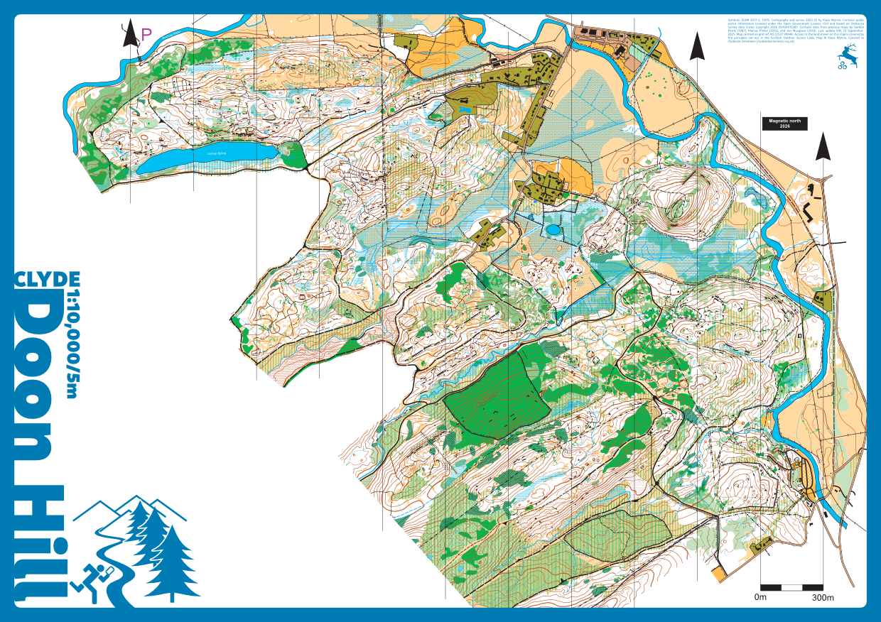
Tha area was first mapped by Gordon Petrie in 1987, with subsequent updates and extensions by Marcus Pinker (2012), Jon Musgrave (2016), and Alasdair Pedley (2022), and possibly contributions from others. As with most maps of its era, the original 1987 map was produced without access to satellite imagery, LiDAR, or affordable GNSS. While topologically sound, it was geographically inconsistent: features were present and correctly related to one another, but their absolute positions were often wildly inaccurate.
At the end of 2023, I obtained new LiDAR data from Forestry and Land Scotland and used this as the basis for a complete remapping from scratch to ISOM 2017-2 standard, with an expansion of approximately 25% to include the area north of Lochan Spling. The legacy map was converted to a georeferenced image and rubber-sheeted to the LiDAR-derived contours, providing a consistent framework for systematically repositioning all features.
This was followed by extensive fieldwork using my GNSS setup, during which all linear and point features (streams, cliffs, boulders, etc.) were checked, corrected, and, where necessary, newly surveyed. Features were placed in positions that are both geographically correct and logically consistent with the landscape and geology. The new extension was, of course, surveyed entirely from scratch.
Vegetation was also completely reworked. LiDAR data were analysed using a normalised difference vegetation density (NDVD) method to produce a detailed and accurate vegetation basemap. This was then generalised into an appropriate representation through further field checks and revisions. Particular care was taken to reduce clutter, maintain minimum gaps, and ensure clear and unambiguous path junctions. The result is a map that is both topologically and geographically accurate, with substantially improved positional reliability, legibility, and competitive fairness.
The map was first used in competition for the Junior European Cup 2025 (JEC) and the Veteran Home International 2025 (VHI) forest relay races on 5 October 2025.
Independently, and without my prior knowledge, the area north of Lochan Spling was mapped at a similar time by Martin Bagness, allowing a direct comparison with a professionally produced map. This provides external validation of accuracy and generalisation decisions and differences of approach (see https://www.livelox.com/Events/Show/167765/JEC-2025-Long). For example, areas of forest where less light reaches the ground but are otherwise runnable at full speed, are mapped by Martin as light green instead of white.

A moody Doon Hill & Fairy Knowe in Jan.'24