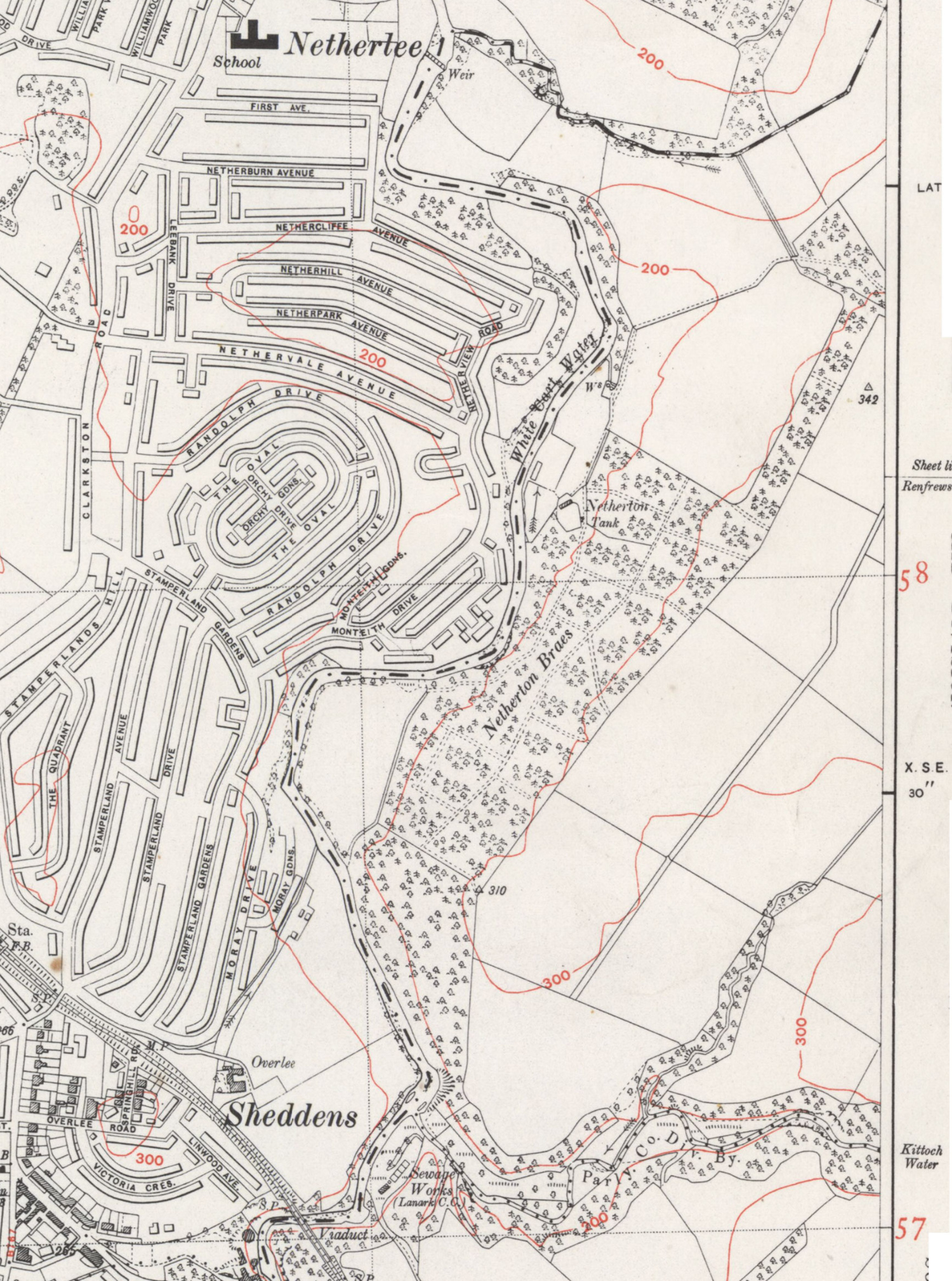
Glasgow South Side mega orienteering map (including Linn Park, Netherton Braes, Cathkin Braes, Fernbraes, Castlemilk Park, Croft Park, and King's Park)
The Original Mountain Marathon (OMM) is a two-day long-distance orienteering event. I thought it would be fun to have a shorter city-based version that's Covid-19 pandemic lockdown compatible. Hence, the Glasgow South Side Original City Marathon (OCM)... The map is based on Phase 2 and 4 LiDAR data for Scotland and includes Linn Park, Netherton Braes, Cathkin Braes, Fernbraes, Castlemilk Park, Croft Park, and King's Park as well as many city streets. The area on the border between Linn Park and Netherton Braes had no LiDAR data (does now), so contours are based on the OS map but are not very detailed (entire man-eating gullies missing). Additional data come from the Strava Global Heat map, 1947, 1949, and 1954-64 OS maps, OS aerial data, STAG orienteering maps for Linn Park, Cathkin Braes, and King's Park, Bing Maps, Google Maps, and many recces.
The OCM course has 31 control points, is 12.5km as the crow flies, circa 16km using the shortest possible route, and 250 to 300m vertical. Please avoid Linn Park Cemetery. The brown dotted lines in Netherton are 19th century forest rides that are just about visible today, maybe... The pits are 18th century coal mining pits 1m to 5m deep. Control #5 on the main forest ride is ~1m deep but pretty obvious once near.
- The course is listed on the SOA website Glasgow South Side Original City Marathon PXAC where the PDF map can be downloaded. The PDF map has four pages (3 map pages and control descriptions) and can be printed full size to keep the 1:10,000 scale.
- The course is on MapRun in the folder UK/Scotland/Glasgow/Glasgow South Side Original City Marathon.
- Glasgow South Side Original City Marathon PXAC map (4/4/21, 6MB).
- The sections marked with a green diagonal cross hatch on white indicate bracken in forest. Green diagonal cross hatch on yellow is open bracken.
- I used x-talons, which are great in the rough terrain but less ideal on the streets (I don't mind).
Cathkin Braes, Linn park
- Maze in Linn park (16/6/21, 4.6 MB)
- Cathkin Braes, long course (6/5/21, 1.4 MB)


Control #25: the remains of Cathcart castle in Linn Park and some graffiti

Control #19: a big old tree

Sun over Kittoch Water (winter 2020)
Netherton Braes on the 1947 OS map (from the National Library of Scotland). I could not see the up/down slope forest rides as there are too many small erosion gulleys but the one along the main spine is just about discernible today.